
Here is my new CDT highlights video:
December 1, 2008 It’s 26 below zero at my cabin outside of Fairbanks. Sunrise is at 10:23, sunset is at 2:57. Hiking across the Chihuahuan Desert of southern New Mexico last May seems like a long time ago!
A few thoughts and stats:
- Total distance was about 2,714 miles.
- Average miles per day overall: 18.7
- Average miles per day during full days of hiking (not counting days spent partially in towns for resupply, etc): 21.4
- Most miles in a day: 33
- Number of “Zero Days” (days I didn’t hike): 8. Three of those days were travel days.
- Pairs of shoes used: 6
- Bears sighted: about 6 black bears and 8 grizzlies
- Favorite stretches: There were many magical places along the way, but the best long stretches were the San Juans, the Wind Rivers, and Glacier.
- Scariest moments?
The night I was sleeping in the open and the black bear walked up so close to me I could hear him breathing, and then when he returned an hour later when I was just falling asleep and he was so close I could smell him!The day I fell violently downhill into the rocks when my foot got caught on an old rusty piece of barbed wire in Montana. I was really afraid I had broken my arm and broken some teeth. The only damage was a swollen forearm.The night when I had just gotten camp set up and a bear was patrolling just out of sight, grunting and smashing trees. (The next morning I found a willow meadow that had been just out of sight and when I saw a bull moose immediately knew it had been him and not a bear at all.)
October 22, 2008 It’s a beautiful sunny day here in Buffalo, WY. I recently returned from a mule deer hunt where my good friend Melanie and I each got a nice buck in a quality hunting experience. We’ll finish cutting and wrapping the big supply of meat tonight.
On a long hike like the CDT a person has to rely on others to a certain degree. There were many people who were very generous with their help, and I’d like to thanks some of them below. Since there’s so many I’m sure I’ll forget to mention some this first time through, so please forgive me (and remind me) if I’ve forgotten to mention your assistance.
- Jim and Louise Hunter drove me hundreds of miles during my “flip” from Cumbres Pass, Colorado to South Pass, Wyoming. It took a great deal of time and expense. They also welcomed me into their home and provided me with many good meals. Thank you Jim and Louise, I really appreciate it!
- Ken Coe my old smokejumper Bro, kept an eye on my cabins for me back in Alaska. He shipped many boxes for me, forwarded mail, trimmed trees, and was simply invaluable in many ways. As usual Ken performed above and beyond the call of duty. Thanks Ken!
- Jim Griffin my smokejumper Rookie Bro really helped me out. He, along with his wife Lora dropped off a food cache for me along the trail in Montana, put me up in their home, set me up with lots of great food, internet access, laundry, shuttled me around, and simply made a great “zero day” at their home near Whitehall relaxing, fun and productive. Jim also took me out on a great float fishing trip when I passed through on my way to Wyoming. Thanks a lot, Griff!
- Marlys Nelson my mother, shipped numerous packages of books and DVDs for me while I was away and did it with her usual efficiency and accuracy. Thanks, Mom!
- Nita and Don in Pie Town, New Mexico, were fantastic. They let me shower and do laundry at their “toaster house,” drove me around town helping me find my missing package, and gave me a place to stay for the night. Fantastic, generous and trusting people. Thanks so much, Nita and Don!
- Kathy, the Pie Lady from the Pie-O-Neer Cafe in Pie Town. Kathy was another great person in Pie Town. Also helped me with finding the famous Lost Package, and set me up with wonderful pie and good meals. I’m not sure what it is about Pie Town that makes it so friendly. Actually, I guess I do know, it’s people like Kathy!
- Nean, aka Let it Be gave me a place to stay at his hiker cabin near Pagosa Springs, CO. Nean has hiked the long trails many, many times and has helped out countless fellow thru-hikers. Thanks for the hospitality Nean!
- Jonathan Ley produced the maps that I and most fellow CDT hikers use as their primary navigational tool on the trail. It’s a huge amount of work and his maps are an enormous savings in expense and time and contain hundreds of nuggets of information. Definitely a “must have.” Thanks Jonathan!
- Courtney and Danny at East Glacier, Montana, gave me a ride into East Glacier for food supplies, then treated me to a fine meal. Thanks guys, it was great meeting you two!
- Addy and Joe whom I met in the Scapegoat Wilderness, were great people. Joe, aka known as “Skippy” is an Appalachian Trail thru-hiker veteran and is planning to hike the PCT. He cooked a fantastic meal for me and the crew the night I camped near the patrol cabin. Addy was also very kind to me. Thanks to both of you!
- John Lyons another smokejumper Bro, sent me supply package which chased me around for much of the summer. This package included an awesome selection of freeze-dried backpacking food that I am usually too cheap to buy for myself. Gracias Juan!
- Dr. Steve Baker, aka Bubba yet another old smokejumper Bro, sent me a wonderful care package. The chocolate covered macadamia nuts were perhaps the best trail food I ate the entire summer. The rest of the package was loaded with exotic and delicious food from Hawaii. Steve, I am unworthy, but thanks!
- The many drivers who gave me rides while I was hitching to town and back to the trail. Many of the names I never got or have forgotten, but I can assure you your kindness will not be forgotten. One name I remember was Ken out of Salmon who drove me well out of his way. There was also the fellow who gave me a ride from Monarch Pass after I had stood there for six hours, the hunter who shuttled me far out of his way down to Leadore, Idaho; Alasdair Boyd, the movie location scout, who drove me from St. Mary to Kalispell; Chris? who drove me from Polson clear to Jim Griffin’s front door; the fellow just back from Afghanistan who gave me a ride up to MacDonald Pass, and many, many more trusting and generous souls. Thanks for helping me out, folks!
- Scott and Anne were Montana hunters who sat me down at their campfire, listened to my stories then sent me on the way laden with goodies. Thanks to you both!
- Mags, Fiddlehead, Spirit Eagle, Haiku, Sly, Yappy, Slow and the many other fellow hikers who offered me advice and encouragement before and during my trip. Thanks folks!
- Melanie Hunter
the most important of all and my best friend, who mailed packages, answered emails and did a thousand other things to make my life easier and my hike more enjoyable. She also hiked with me three times during the summer. Thank you, Melanie! - I’m hiking the Continental Divide Trail.
- The Mexican Border
- About 20 miles a day or a bit more on full days of walking.
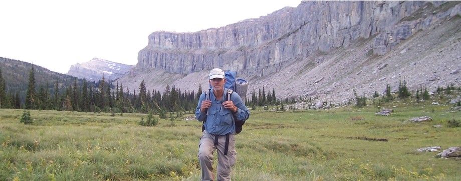
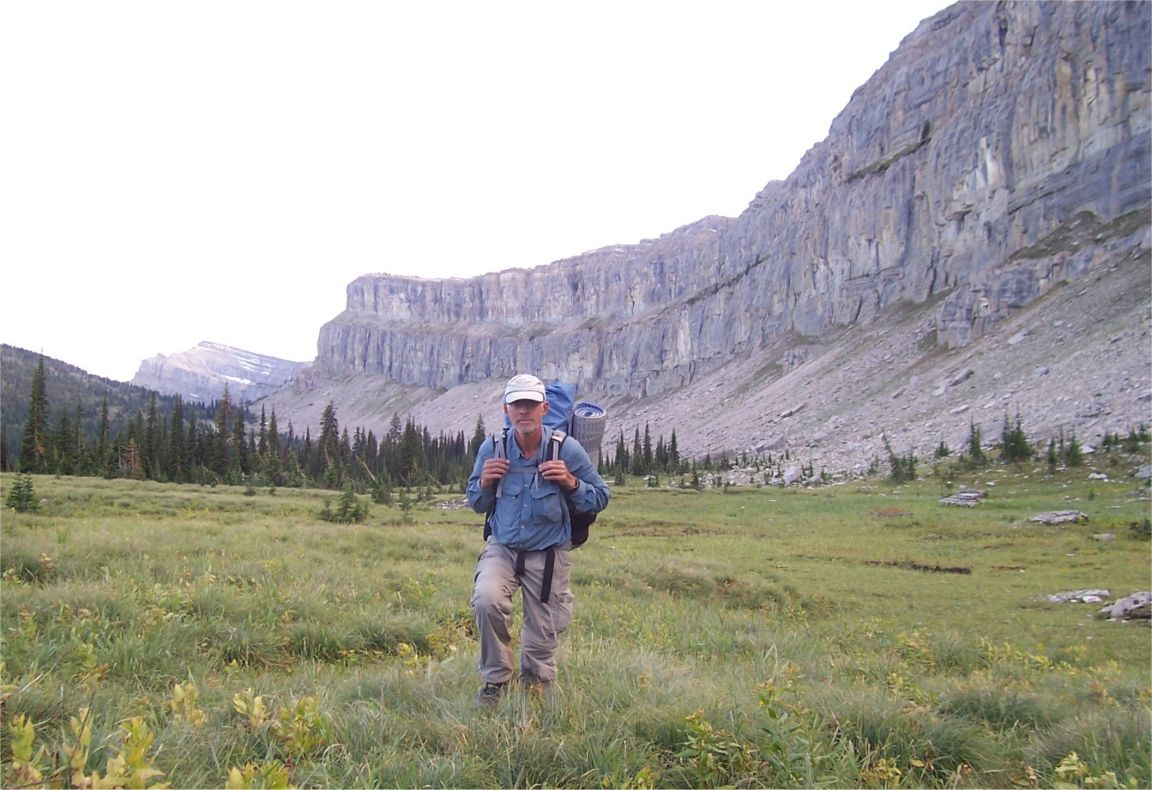
- At the Canadian Border at Glacier National Park
- Almost 4 months so far.
- Hopefully I’ll finish at the end of September sometime.
- Yes, I’ve seen about ten bears or so.
- I’m hiking alone.
- Nope, no gun.
- My pack weighs about 20-30 pounds, usually.
- This is my fifth pair of shoes.
- I guess I’ve lost about 13 pounds but I’m holding at about the same weight.
Oatmeal, Poptarts, granola bars, pasta, rice, peanuts, dried fruit, peanut butter, chocolate, jerky, tuna, ramen, and just about any food that doesn’t have water in it or come in a heavy can. I also eat a lot it towns! - Yes, it is fun. Fun and a huge amount of work!
October 7, 2008 I’m in Wyoming getting caught up on my off-trail life and it feels good. I’ve added many photos, so please scroll down and check them out. I will be adding more information this month so check back again soon!
October 1, 2008; Buffalo, Wyoming Wow. It’s over, another great adventure of my life. I had to wait most of the day in Waterton for a shuttle across the border. I spent it doing laundry, eating and catching up on news. While waiting for the shuttle, I ran across a person hiking in Waterton Park. I saw his hat that said “trail crew.” When asked, he said that he worked on the Appalachian Trail sometimes and that he had thru-hiked the trail in 2001. “Really?” I said, “What’s your trail name?” “Louisiana Bear” he said. It was then that I recognized him. “We shared a room at Elmer’s in Hot Springs! You gave me your extra food!” I said. What a small world it is. I made it to St. Mary late that afternoon and it took me a another full day to hitch to Jim Griffin’s house. The last fellow gave me a ride right to Jim’s door. I’ve added a number of new photos below, and plan to expand some posts and add more photos, so please check back. Have a good day!

CANADA!!!!!!!

Mule Deer Buck

Last camp, moments after the grizzly ran by!

Bighorn Sheep Ewe, Glacier National Park

Climbing in Glacier

Fall Colors, Glacier National Park

Service Berries, (Blue) with Mountain Ash Berries
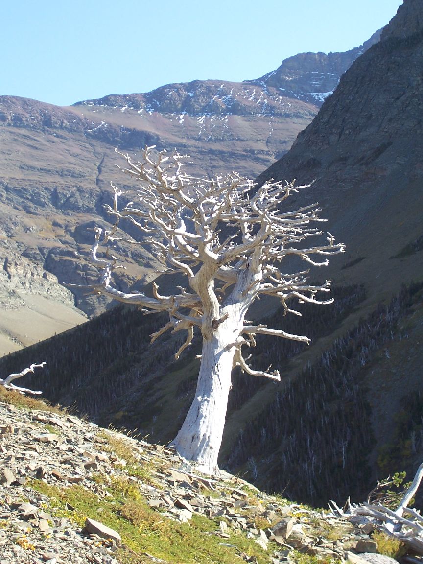
Skeletal Tree
Chinese Wall, Bob Marshall Wilderness
Grizzly

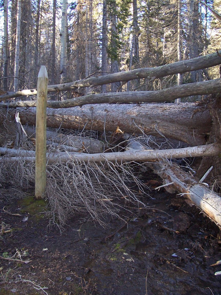
Grizzly-Chewed Sign, Bob Marshall
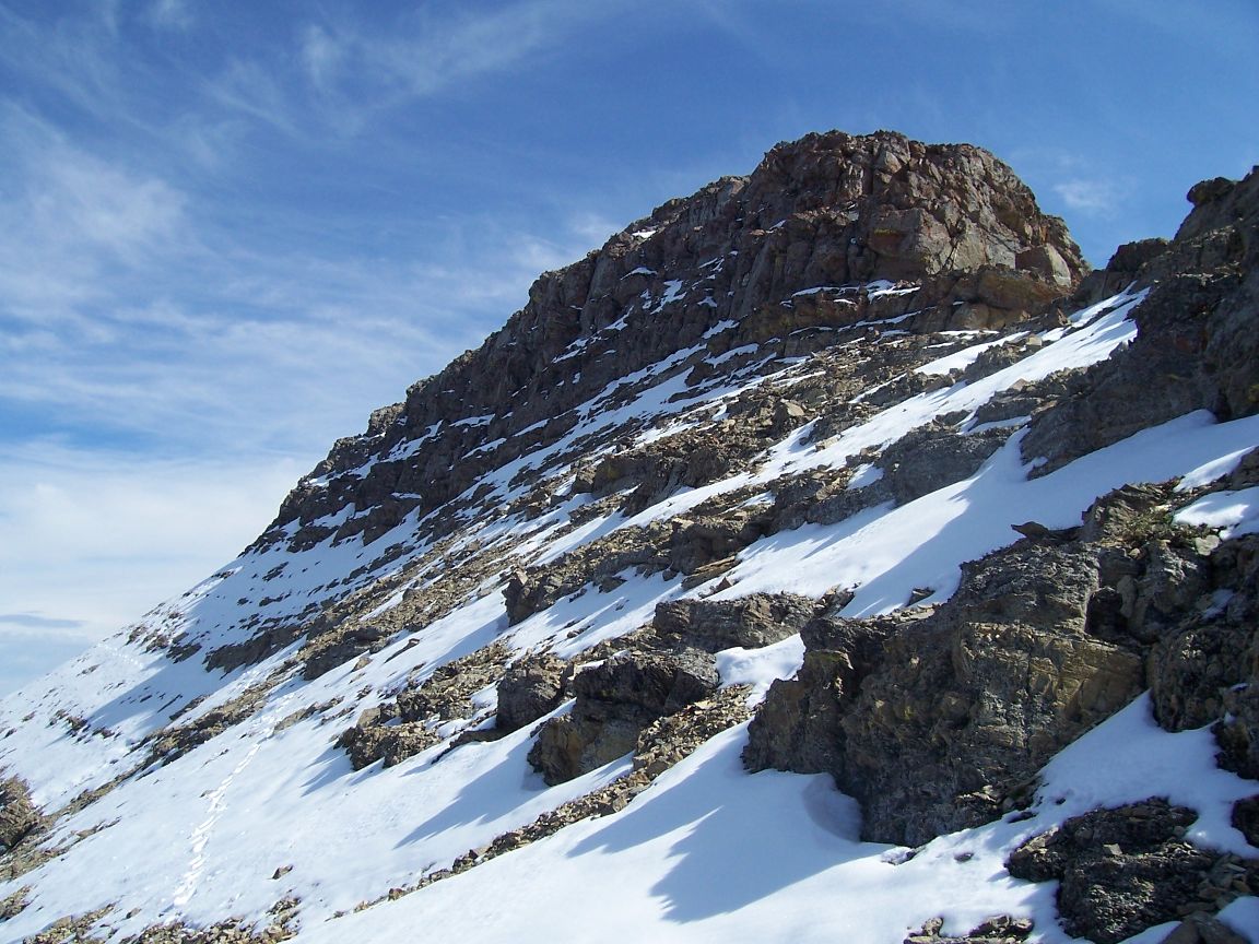
Snowy Cliffs in the Scapegoat Wilderness

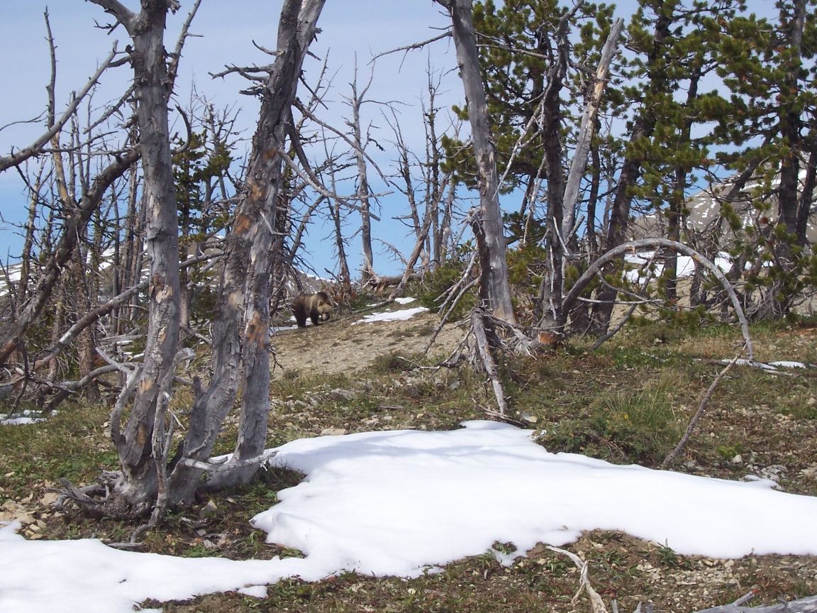
Grizzlies, Scapegoat Wilderness
August 30, 2008; Whitehall (Pipestone Pass) Montana I’ve made it to my old smokejumper buddy Jim Griffin’s place in Whitehall, Montana. Things have been going great. I did 80 miles in three days of the last stretch which is a fast pace for me in the mountains. The whole section was about 146 miles total. The highlight of the last stretch of trail was the Anaconda-Pintler Wilderness. Beautiful country indeed, featuring dramatic mountains and mountain lakes. There were some stretches with a lot of climbing, however, but there were also some very mellow stretches. Jim and family dropped off a food cache for me near a trailhead along the way which lightened my pack, and boosted my calorie intake. It was also loaded with goodies. It felt like Christmas! One day I heard the thunder of hoofbeats and I hurried ahead, expecting to see elk but it was a band of goats, mostly or all nannies with kids. They looked at me then thundered off for the cliffs. Good thing I wasn’t a wolf because they weren’t very fast compared to an elk! According to my calculations I have about 430 miles or so left to hike. There was a dusting of snow one day and there was a cold front that made for a couple of chilly days. Cool days are perfect for hiking hard and that helped my hiking speed. I’ve added a few new photos, below. Enjoy your Labor Day Weekend!
Black Wolf
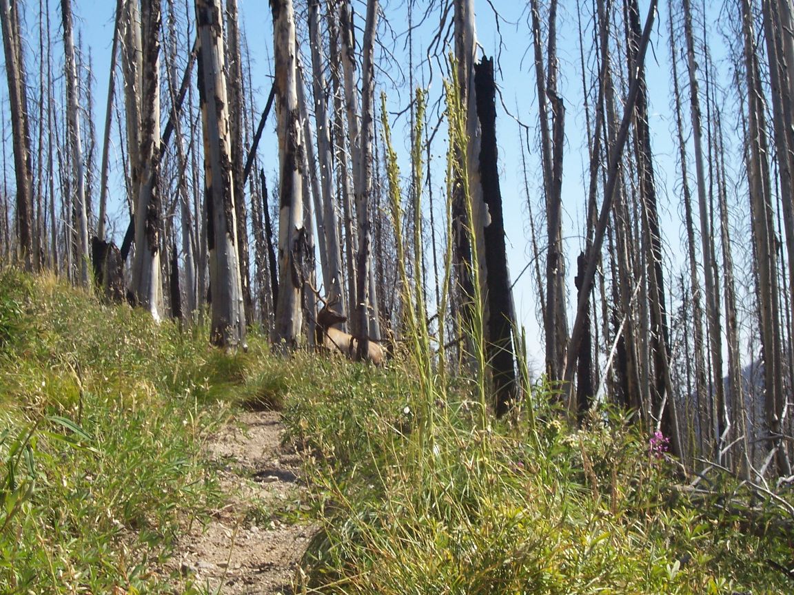
Bull Elk

Anaconda-Pintler Wilderness
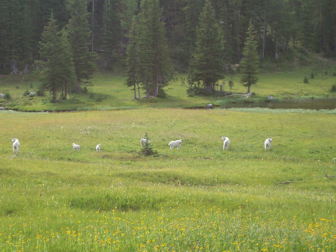
Mountain Goats
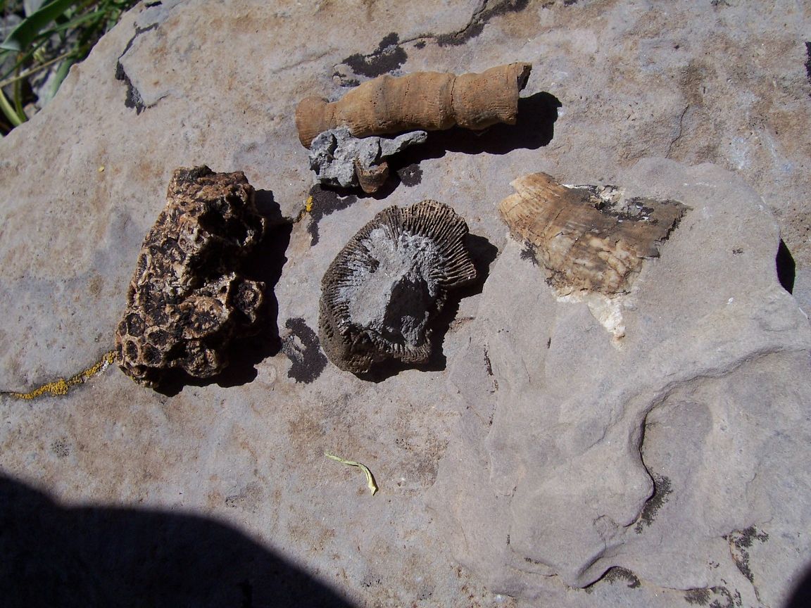
Montana Fossils
Since just after Macks Inn the trail has run mostly right along the Continental Divide. It makes for very nice views but is also a lot of work at times with all the climbing and descending. I’ve seen quite a lot of animals including elk, deer, mountain goats and antelope. One night I was sleeping out under the stars and was just falling asleep when I heard breathing. I sat up and there was a bear just over 20 feet away. Seems he was just walking down the ridge and had stumbled onto me. When I yelled at him he ran a short way then disappeared when I yelled again. I figured he’d be back because of that pause, and sure enough, an hour later I heard something. He was so close I could smell him but that time I yelled like I meant business and he was gone for good. It was a younger bear, looking for some free chow, no doubt, but not looking for trouble. A couple days later I was walking down the trail and spotted a black animal nearby and immediately thought “bear!” But then I saw it was a black wolf, with another one that spotted me right away. The first wolf grabbed a mouthful meat and trotted off towards the first. I got my camera out and walked quietly down the trail. I ended up seeing about five black wolves and got some photos and video clips of them. I have great luck seeing wolves! The weather overall has been great. There was a some strong winds and cold rain and sleet yesterday afternoon, but it ended about the time I got to the road. (Luckily I got a ride fairly quickly because it was already about 7 PM.) Unlike Colorado, I haven’t been chased off the ridges by lightning yet in Montana/Idaho. The days still are running quiet warm, even hot with fairly mild nights now, but you can still feel fall in the air at times. I’ve been eating some ripe berries and some of the ground plants are starting to turn. The wildflowers are past their height but there are still beautiful pockets of them. One of the many passes I’ve crossed is Lemhi Pass, where Lewis and Clark first crossed the Divide. What made that spot additionally thrilling for me was the gift of a complete bag lunch by a tour group! Just about everyone I meet is super nice, but I still often go for days without seeing a soul. There is a lot of stunning high mountain scenery. Often, when I see the ruins of a cabin in a breezy mountain meadow I think about the old pioneer song that went “Come, come, come away with me, where the grass grows wild, where the wind blows free.” Thanks to all the people along the way that are helping to make my hike possible. Have fun, everyone.
Lima Peaks, Montana

Camp in Wildflowers

Sunset on the Divide
August 4, 2008; West Yellowstone, Montana It has been a nice stretch of trail over the last few days. The weather has been very good. One night a big grizzly walked right by my tent but I didn’t know it until I saw his tracks in the morning. The next day, after I’d made it into the park, I jumped a grizzly at close range. I heard his “woof” but didn’t see him until he cleared the brush and was running up the mountain side. I made good hiking progress, making it to the border of Yellowstone Park exactly 3 months after I started the hike. Melanie met me at Heart Lake and we hiked as far as Old Faithful, today, after camping a couple of nights along the way. The walking has been unusually good, and it was fun to walk through some geyser basins with no one around, a far cry from the hubbub at Old Faithful. I went into the Inn there for the first time though and it was really impressive. This morning we ran into the first southbound thru-hikers (SOBOS.) Enthusiastic and fine fellows. It’s always fun to run across fellow thru-hikers. There were no rooms available in the Park, and we didn’t want to stay in the “concentration camp” campgrounds after camping in the wilds, so we just drove to West for laundry, showers and pizza, and internet access. Melanie is going to walk with me through the geyser basin north of Old Faithful tomorrow and then head home. I’ll hike beyond the park border tomorrow as no backcountry sites are available in that area of the park. Thanks to JL and Bubba for the “care packages!” Take care, all.
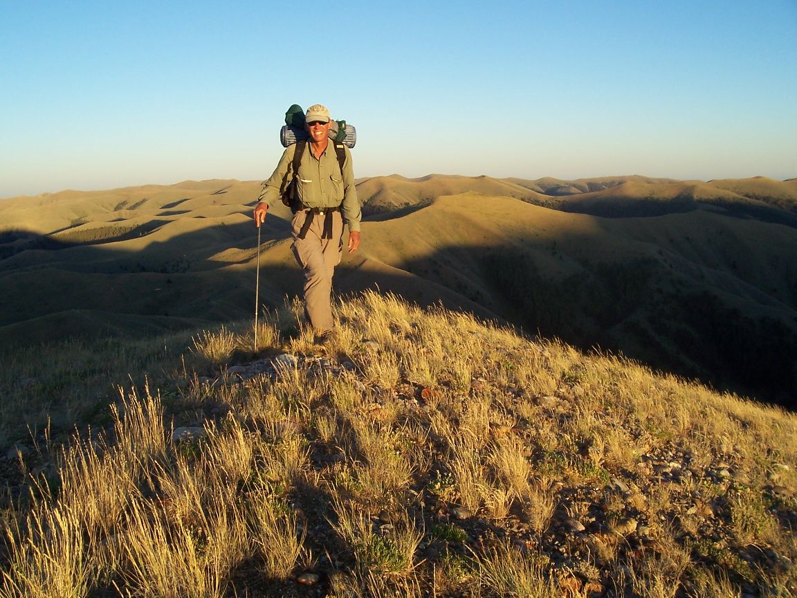
July 30, 2008; Togwotee Pass (Dubois) Wyoming Hi Everyone! I’ve spent nearly three months on the trail and have covered over 1,600 miles. The Wind River Range was awesome. My good friend Melanie and her little yellow dog, Jack, hiked with me for about six days which was great. The mountains were amazing with a completely different character than the San Juans, for example. The Cirque of Towers is perhaps the most impressive sight in the American Rockies, and Squaretop Mountain, to the north, may be my favorite peak. We had three big meals of trout which was real treat. Jack enjoyed the leftovers. The wildflowers seemed to improve each day. My camera had a software glitch towards the end, but imagine mountain meadows with thigh-high daises, along with blue, violet, purple, white, pink and red flowers in profusion all against a spectacular mountain backdrop. One day I was hiking down the trail and saw a big black dog trotting down the trail towards me, followed by an equally large gray dog. When another big black dog appeared I knew it was wolves! When we made eye contact they bolted for the timber. It was very dramatic. Two hours later I saw a black bear that never saw me. A surprising lack of elk in the Wind Rivers, however. Well, not much time on the computer. Going to head back to the trail. The next stop is Yellowstone. Enjoy your summer!
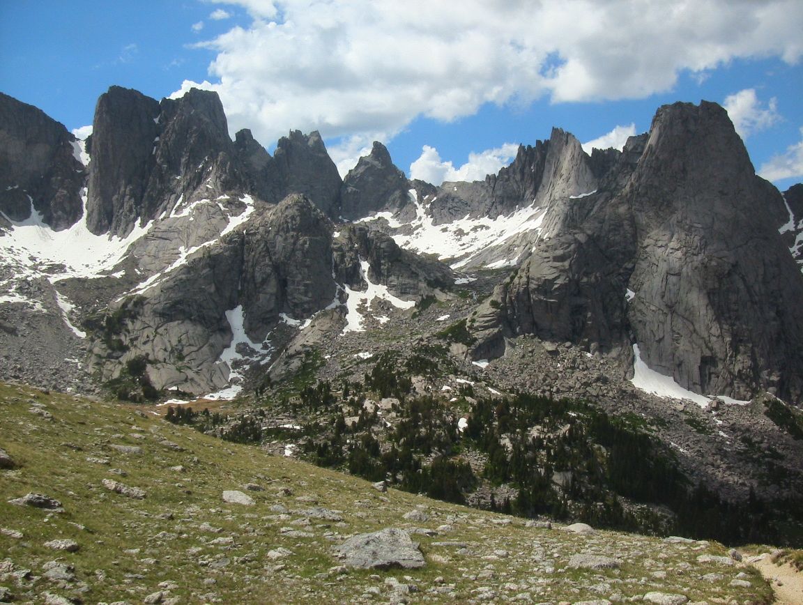
Cirque of Towers, Wind River Range
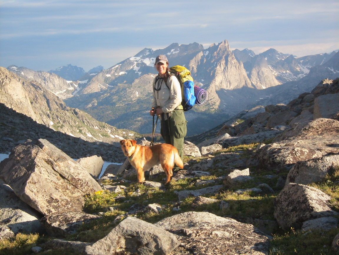
Melanie and Jack, Wyoming Mountains
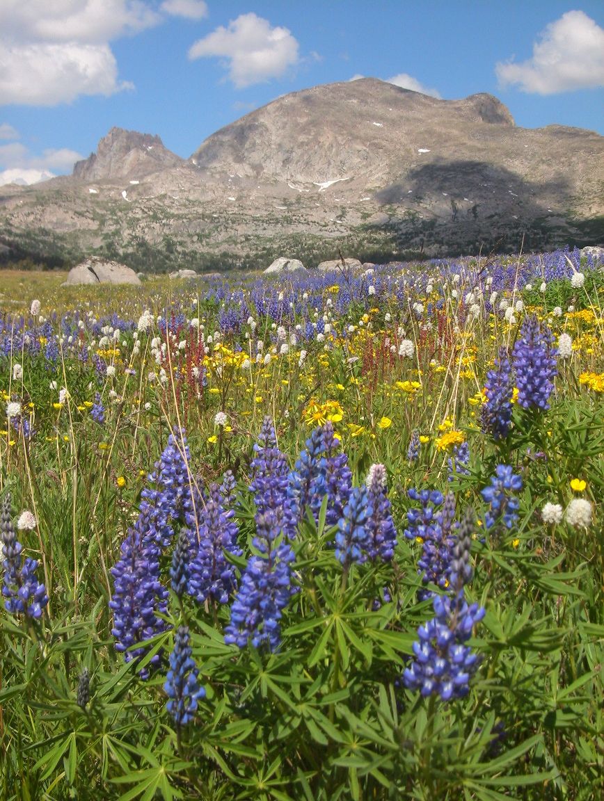 Wildflowers, Wind River Range
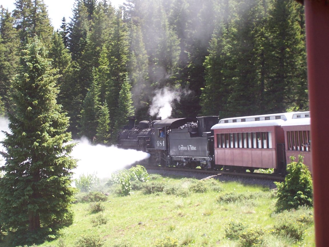
Cumbres & Toltec Railroad

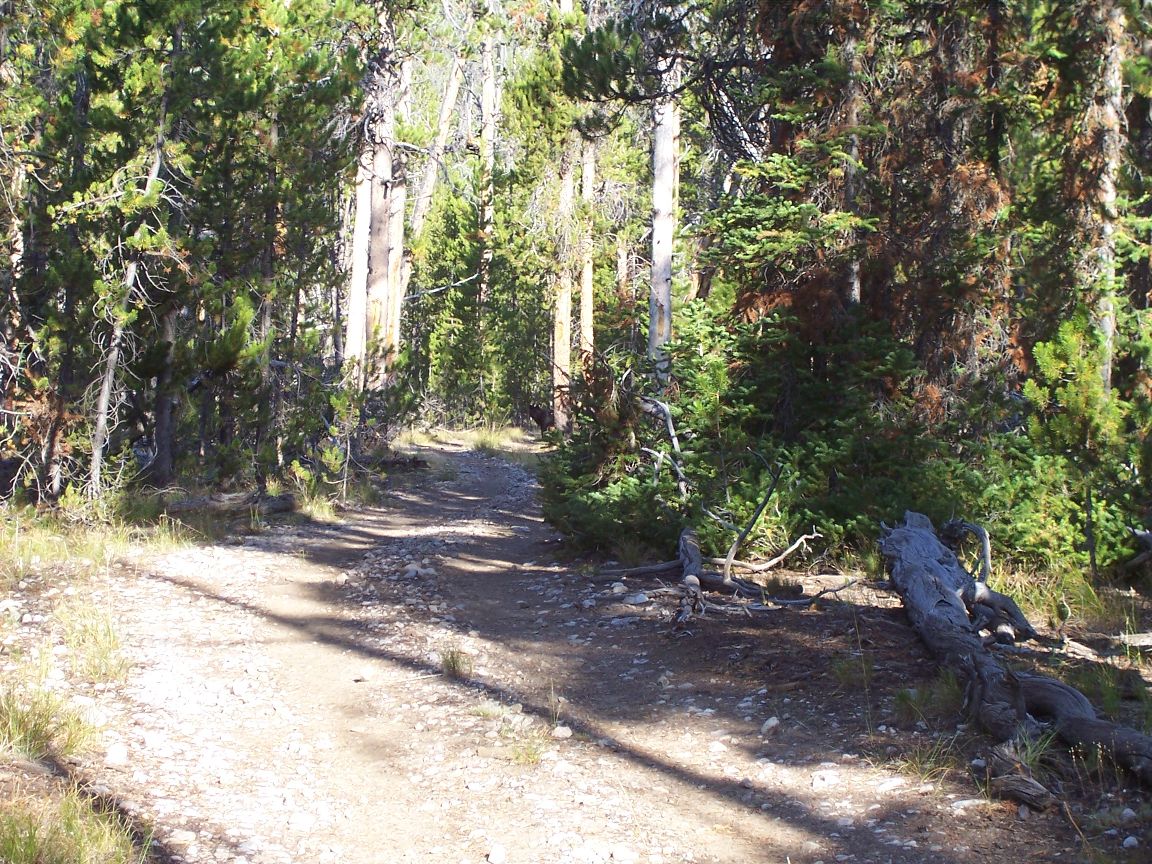
Trail on the Divide

Camp at Stoney Pass
North San Juans

North of Stoney Pass
Nebo Lake

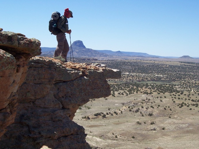
View From Hunchback Mountain
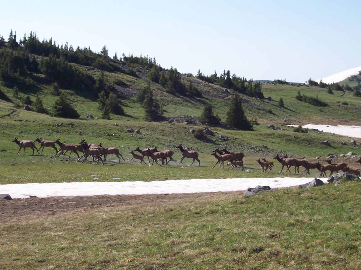
Elk Herd
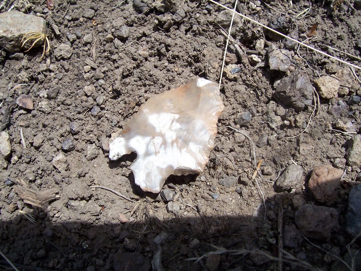
Arrowhead
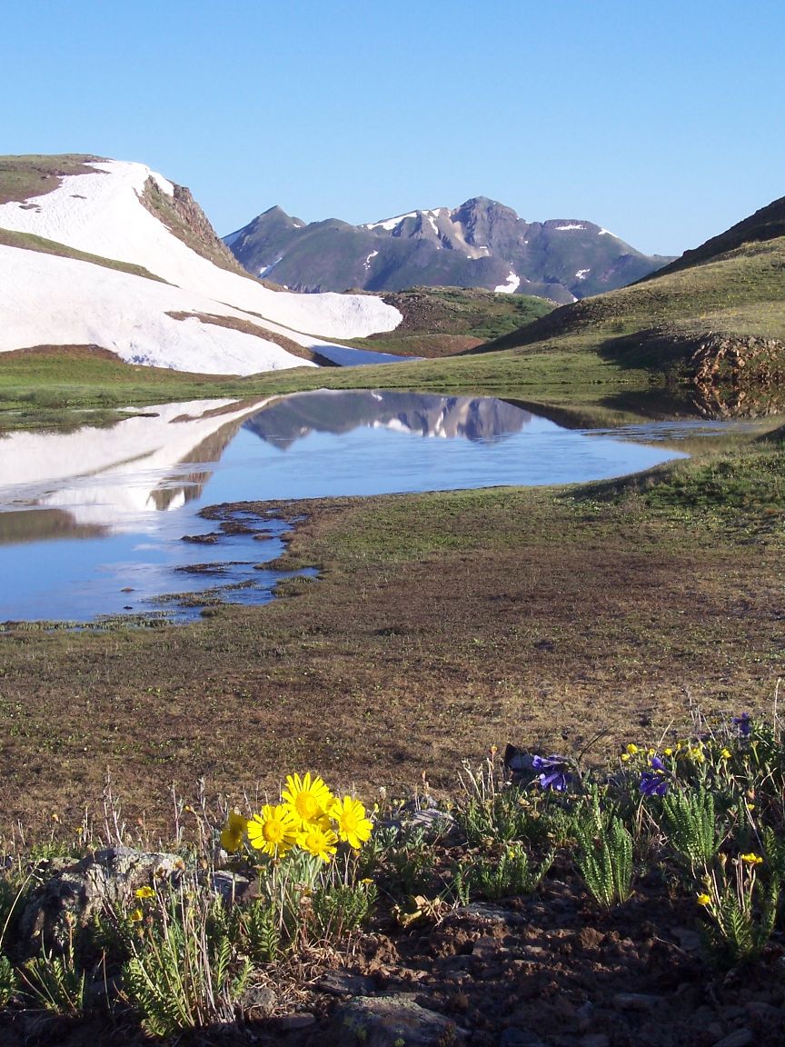
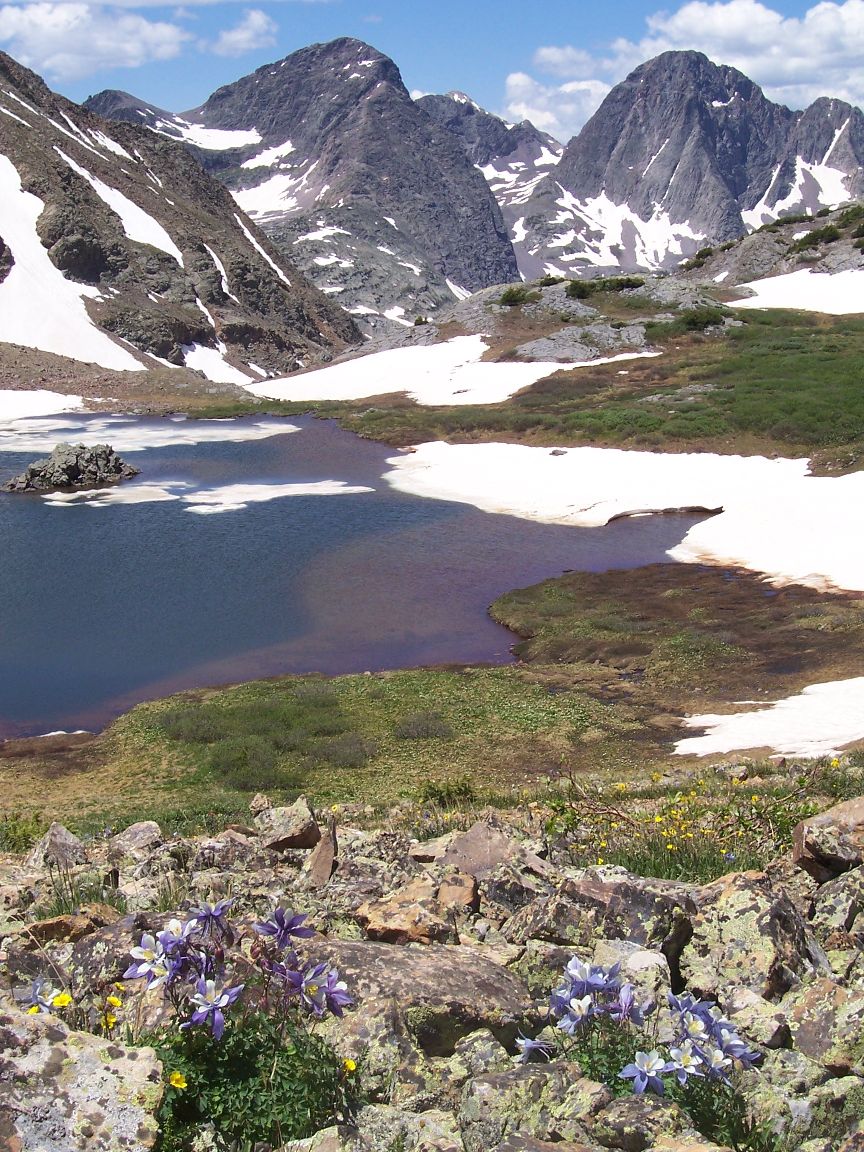
There’s been many 12,000 foot passes to cross. The night before last a fisherman treated me to several brook trout which was a great gift as I was low on food. After 6 hours(!) of trying to hitch in sun, rain, sleet and hail I got a ride into Salida last evening. It’s been challenging but a great adventure!
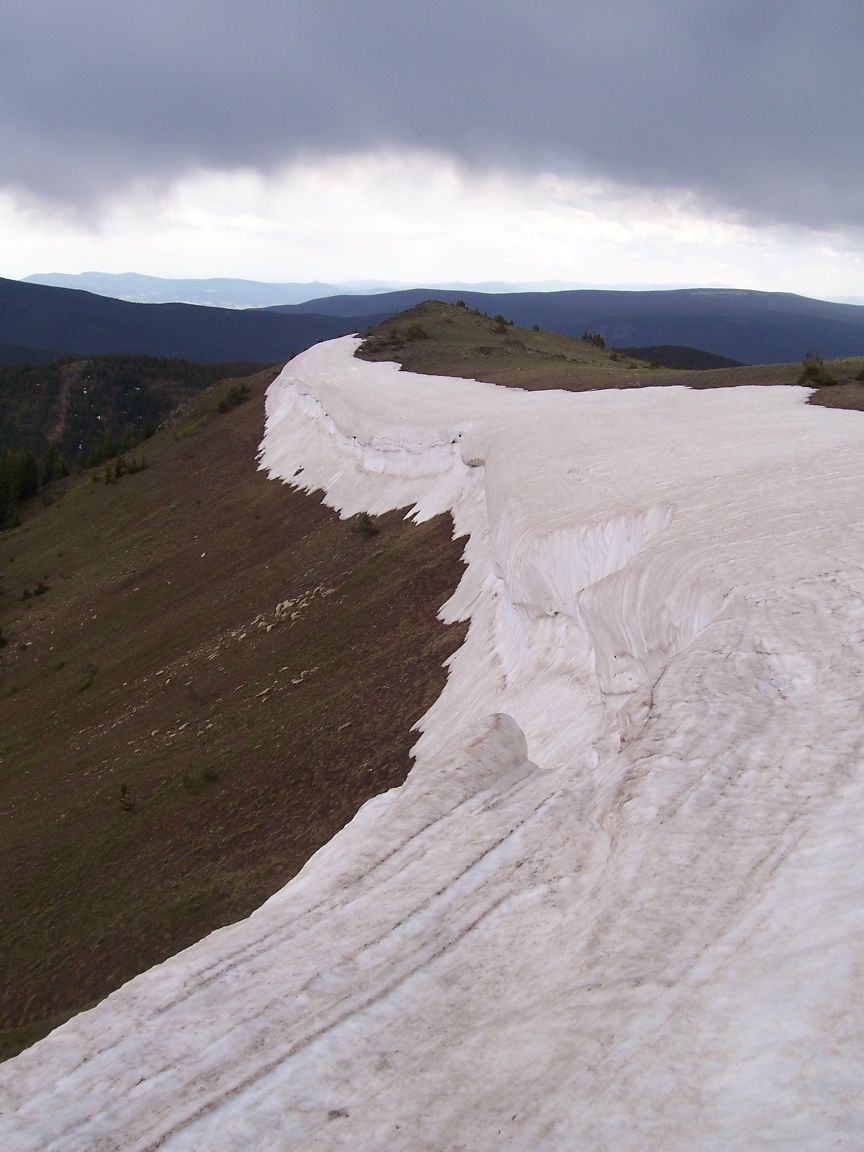
Snow Cornice

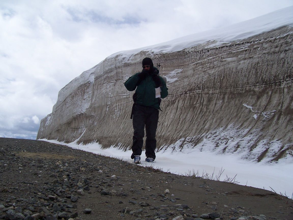
Near Monarch Pass

Mt. Elbert
June 19, 2008; Silverthorne, Colorado Not much time on the computer, as usual. I’m on the computer here in the library. I made the long hike up to Rabbit Ears Pass from Steamboat. In the wide open spaces on the south slopes there were some bare patches, but the snow was still deep in the shade. The last few days have been warm, however. I did another stretch “off the crest” hoping to give the snow some time to melt. There was a good thunderstorm early this morning but it didn’t rain much. Haven’t had to deal with much rain on this trip I’m happy to say. But most days thunderstorms have been building up though they’ve been skirting me so far for the most part. Not many stories to tell as I’ve been doing lots of road walking. Tomorrow, though, I’m heading up high to see how the snow situation is at the 11,000 foot level. People continue to be very nice. Have a good day, everyone! Buck
June 15, 2008; Steamboat Springs, Colorado I just walked into town having covered about 900 miles total. Lots going on here. I hit what you might call a “perfect storm” in navigation south of Rawlins. It turns out about the first two days worth of topo maps south of town had been lost when some of my maps blew away. And it happened that this was time when I made the mistake I hoped to avoid, by getting my guidebook portions in the wrong package. So southern Wyoming was missing. My plan was to just head south until I got back on my topo maps. The first night it snowed in sage country. The next day was nicer but then an ugly storm blew in. I’m not sure what the definition of a blizzard is, but it was below freezing and snowing so hard in a howling wind I could only see about 50 feet. About five cars went by and four of them asked if I wanted a ride which was very kind of them. Anyway, most of the roads weren’t identified with signs, and to add to all of that my GPS failed! First time I’ve ever had that happen. It has stopped picking up satellites. Anyway, the skies cleared enough so I could identify some landmarks and I got back on the trail. The snow got deeper and deeper up high. I made a “winter camp” that night in the deep snow and built a fire for the first time on this trip. The next day the snow got even deeper and it became impossible to follow the trail. Although I could often tell from my maps when I should be on it I was wasting a good deal of time navigating, floundering through three feet of snow and just generally working ridiculously hard. Usually I could stay on top of the old snow but I’d often punch through, too. I knew I had day after day after day of deep snow ahead of me, and as it warmed up I’d be “post-holing” even more, so I elected to drop down to a lower route and follow roads. It only took about two hours to get below the snow line and it was a different world. It went from a desolate winter setting with blowing snow to new green leaves and wildflowers. I’d only brought enough food to get to Encampment, Wyoming, but after taking stock of what I had and looking at the very un-detailed maps I had covering the area off the actual CDT trail, I decided to make a push for Steamboat Springs. That evening I talked to a guy out exploring in his 4WD and he said there was a store or two along the way. The weather has been perfect the last two days. Highs in the 70s and a cool breeze. I saw many elk the morning I got into lower country, with numerous calves. There was one bugling in a fairly large herd of about 25 animals which seemed very unusual for this time of year. There were also deer and antelope. I didn’t know about bridges across the river ahead of me, but a guy out working on his irrigation directed me to a ranch bridge nearby. From then on it was smooth sailing. Along the road into town were countless beautiful homes, many in picture postcard settings. I camped one night in a “white picket fence” of leafless aspens. One next to my camp had “September 11, 1940, Heading to Wyo today.” carved on it. I was pleased yesterday to hit a restaurant for breakfast. I was hungry and have lost about 10 pounds, so I ordered two excellent breakfasts. The waitress told me summer was running a month late. Down the road three hours later I ate a big lunch at another restaurant, then stopped for the obligatory ice cream at a little store nearby. Now I’m here in Steamboat. I will be buying supplies and a new GPS and try to figure out the snow situation ahead of me. I really want to avoid the deepest snow and of course time is working in my favor with nice weather predicted for the next few days. Basically all is well and I’m driving on. Happy Father’s Day!
Snow Drift in Wyoming

Aspens near Columbine, Colorado
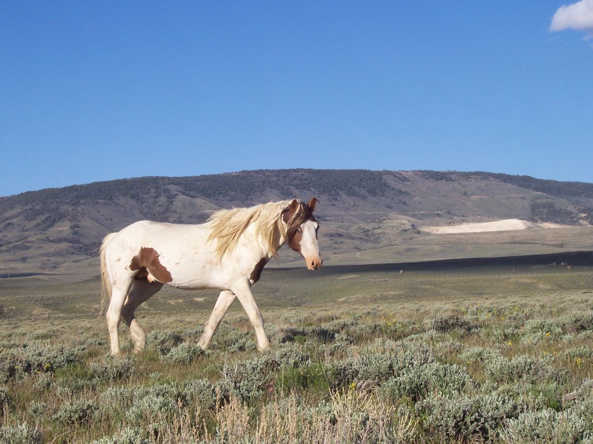
Wild Horse; Red Desert, Wyoming

Medicine Bow Camp
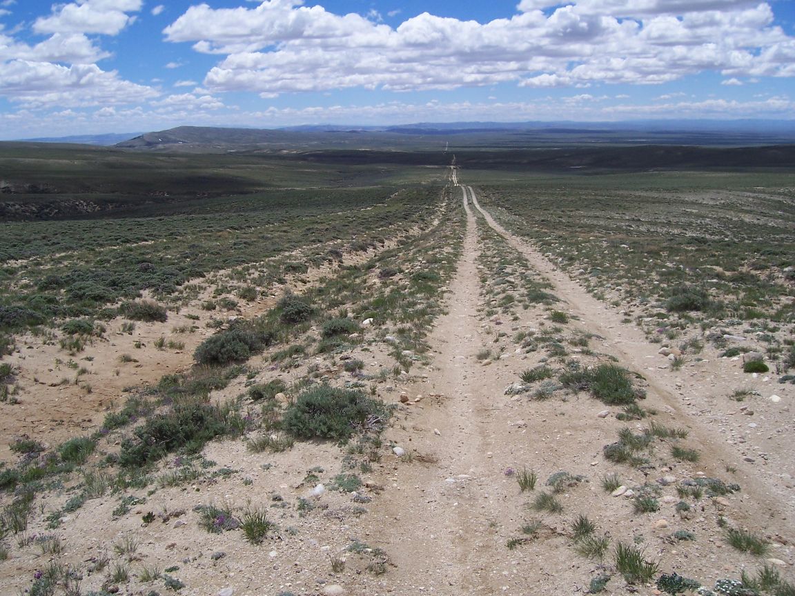
Red Desert
Meadow, Northern New Mexico
Grave from Apache Wars, Cooke’s Canyon
Rough Trail!
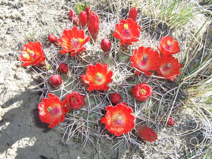
Cactus Flowers

Rattle Snake Diving for Cover
Rimrock Country

Desert Camp
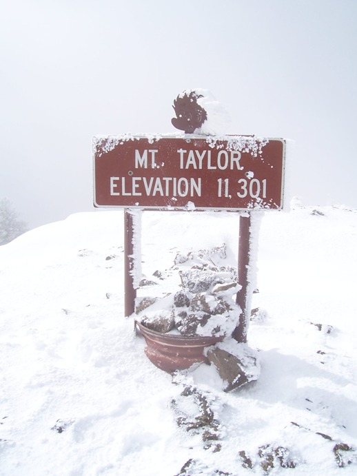
First Deep Snow, Mt. Taylor
May 22, 2008; Grants, New Mexico One more piece of trail behind me! I’ve now backpacked more than 400 miles. Every day the mission is to see and enjoy things I encounter as much as possible while cranking out the miles. Most full days of walking I’m doing over 20 miles a day now. Town stops make for shorter days mile-wise, of course. The clock is always ticking for the winter snows of Montana. If things go well I hope to finish by mid-October, but if you look at the map there’s still a long way to go. 1/7 of the trail done, though! I saw two more CDT thru-hikers, with trail names of Sharpshin and Strix, checking out of the motel as I arrived so that’s about 5 total that I’ve seen. Very few other backpackers except in the Gila Wilderness. This last section has been a lot of walking along quiet roads but also included the Zuni-Acoma trail across lava fields which was many miles wide. The stone cairns marking the way were mostly placed there hundreds of years ago. Drinking water was a big issue on this stretch, too. At one point I was completely out and lucked out by hitting the clearest cattle tank water I’ve encountered yet. Of course I treated it and I was mighty glad to have it. Seeing cows is a good sign of nearby water and a spinning windmill is a welcome sight. Grants is about 6,500 feet or so in elevation, I think, so it should have been no surprise when it started snowing as I started walking this morning. It changed to rain which has come and gone the rest of the day. Wind is common in New Mexico and it had a real bite this morning. Along my route a few days ago was an old Indian ruin, so I explored the area and found a big rock with several very impressive petroglyphs. I also started seeing pottery shards. A few here and there and then so many that I had to be careful not to crush them. Many still had beautiful geometric designs on them. That evening I camped and I could see several from my sleeping bag. I also found a very nice black projectile point. All were left where they lay. One story I forgot to tell earlier is when I was at the border at Palomas, just on the U.S. side. It was one of the greatest concentration of law enforcement I’ve seen in the U.S. with several Border Patrol vehicles, several Border Patrol working the entry point, numerous military personnel and of course a fence all along, currently being beefed up. I watched as an illegal, having found a hole in the fence, sneaked through the weeds in broad daylight and successfully entered the U.S. I guess he knew “the drill” and just waited for a gap in the patrols. Well, I have to wash clothes, shop and answer emails. Have a good day, everyone!

Collared Lizard
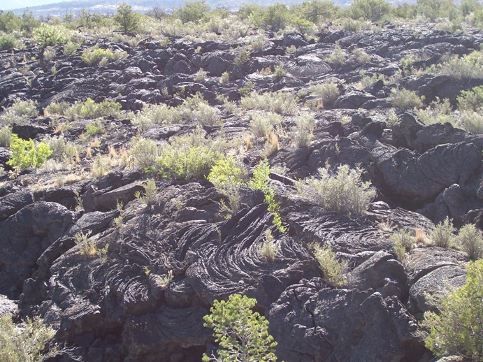
El Malpais, Zuni-Acoma Trail

Ancient Pottery Shards

Gila Cliff Dwellings
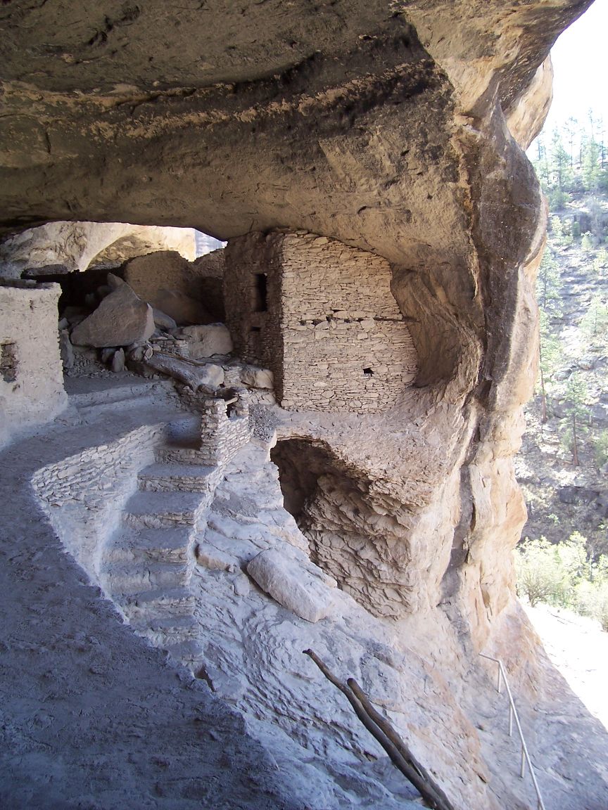
Cliff Dwellings
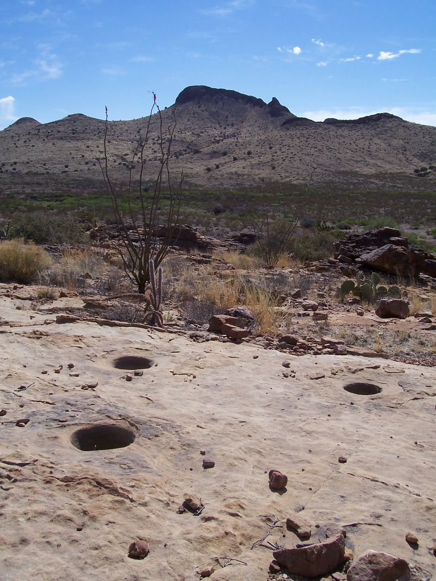
Centuries Old Indian Grinding Holes
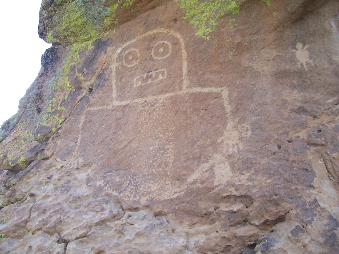
Petroglyphs in New Mexico

Petroglyphs North of Deming

Getting Flowing Water from a Windmill Pipe
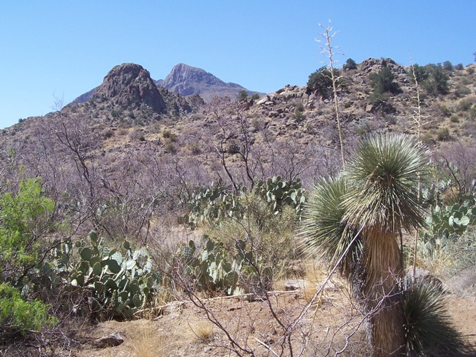
Cactus and Tres Hermanas Mountains
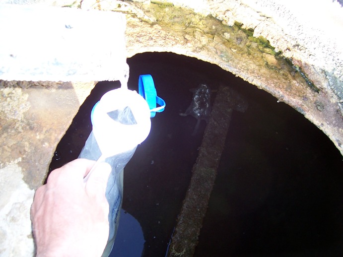
I was delighted the wind was blowing and the windmill was pumping because there was a packrat floating in this water tank!
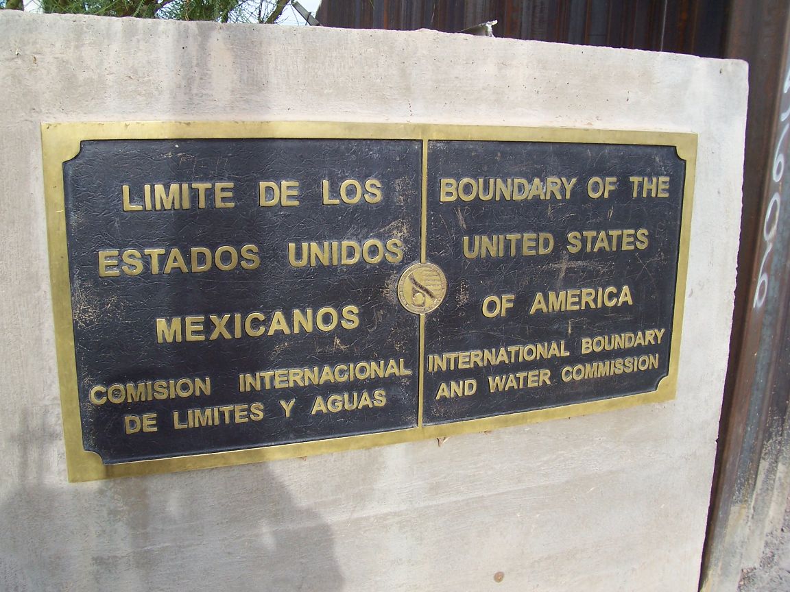
Mexican Border
April 27; Buffalo, Wyoming 2008 I’ve got a bus ticket for the LONG ride to Deming, New Mexico, via Denver and El Paso. Starting at 3:50 AM on Tuesday, April 29, and arriving in Deming about 8 AM on the 30th. After what will hopefully be a quick hitch to the border, I’ll start walking north. I’ll probably get lunch in Columbus, New Mexico and leave there with about three days of food to get me to my first resupply point about 54 miles away back in Deming. A major goal for the first stretch will be to carefully pace myself. A common problem with those starting out seems to be pushing too hard and blistering still untoughened feet. Updates here will be random depending on internet access and when I arrive in trail towns, but they’ll likely average about one a week.
April 16; Fairbanks, Alaska 2008 I have been preparing for weeks to leave for the CDT, but these last few days have been extremely busy. So many details to iron out; for the trip, for personal business and for Buck Publishing. Happily I’m having to deal with a rush of orders spurred by a glowing review of Alone Across Alaska in Backpacker Magazine. I fly to Wyoming on Friday, April 18. I’ll spend about a week in Buffalo before heading for New Mexico to start the trip.
April 6; Fairbanks, Alaska 2008 Time has gone quickly. I’ve been very busy. On March 31 I officially retired from smokejumping. Being a smokejumper was a defining experience in my life. I’ll look back on those years happily, and I happily look forward to upcoming experiences.
I’ve just about completed last-minute gear purchases, things like lightweight guyline cord, gloves, a new compass and sleeping pad. I’m selecting towns for two or three maildrops (maps, food, batteries etc.) in New Mexico, but will wait for the other states until I have a better feel for how my hike will progress. I’ve got my maps gathered, having printed up Jonathan Ley’s maps, acquired state road maps for the big picture and purchased the DeLorme maps for the northern states and Mapsco maps of New Mexico for a mid-scale view.
Surprisingly, perhaps, most of my efforts are going towards arranging my personal affairs for months spent (hopefully) on-the-trail. For example, finishing up my taxes, arranging for someone to look after my property and rental cabins, making sure my bills will be paid and my books and DVDs will be shipped by someone competent. All that, too, is going well, but it’s a big, time-consuming task. It will make the relatively simple life on the trail this summer all the more pleasant, just as returning to the comforts of home after the trip will make the everyday luxuries more appreciated.
March 18; Fairbanks, Alaska 2008: My preparations are going well. I fly south to Billings a month from today (April 18) and I’ll spend about a week in Buffalo, Wyoming before starting my hike from the Columbus, New Mexico, terminus. There are three choices of where to start the hike at the south end, and I have chosen the CDTS “Jim Wolfe” route.
Hey Buck,
Any chance you made a gear list for this as well?
Thanks,
Jake
Hi Jake,
I don’t have a posted list for this hike, sorry. It would be similar to my PCT list except for a few items like a warmer bag. A good 20 degree bag was a good choice for me, supplemented with a balaclava, down jacket and long underwear on the coldest nights when I went to bed chilled. The CDT can be a cold trail.
Have a great hike,
Buck
Hey thanks for the response Buck. Planning has come along way and we are set to do a SoBo thru this summer. Not sure if we are going to start hiking North from Yellowstone early June and flip flop after Glacier, or wait until the trails free up of snow and just start hiking South from Glacier early July. Either way we are beyond excited.
One more question that I already have a lot of ideas for, but I would like to hear a little about your process. How did you approach food? I’d like to eat well (calorie packed) and keep myself from becoming bored of the same old food everyday. I’m thinking about doing a mix of homemade dehydrated meals and brand name freeze-dried foods as well as the usual trail mixes/granola bars/etc. Of course I am also accounting for random meals we may purchase in towns for the first couple days of a new section. Thanks again for your help.
Jake
Hi Jake,
Everyone has their own approach to food, but for me it’s not a good idea to buy/prepare all, or even most, of my food before the trip. Variety is crucial. I also try to buy along the trail as much as I reasonably can. When “mail drops” makes sense, I like to buy in trail towns and mail ahead to myself as needed.
I’d recommend planning your food supply for only one state at a time so you can modify your strategy as you go. Personally, I don’t do any dehydrating and buy almost no freeze dried meals, either. To quote myself Some of my common foods were peanut butter, granola bars, Poptarts, cold cereal, Snickers, those Knorr’s pasta/rice meals (around 5.5 oz.), Idahoan Potatoes, Ramen, nuts, crackers, peanut M&Ms, cheese etc. Just about anything without water in it! Each time I buy food I have the option of varying my diet. I wander grocery store aisles “thinking outside the box” and buying new, different stuff often. In trail towns I like to make sure I eat fresh fruit and salads and major calories.
If you stay flexible, keep track of where your next three or four supplies will be and plan accordingly, it’s hard to go too far wrong.
Have a great hike!
Buck
We are planning on riding our mules from the NM / Mex border and going north on the CDT. We were going to start gathering by purchasing the Ley map. Other suggestions etc for planning this trip. We are looking at leaving June 1 from NM.
4 mules, 2 guys.
Thanks for any suggestions made. Jon Peotter
Hi Jon,
For backpacker’s I always recommend Yogi’s guidebook. You will undoubtedly find it useful as well.
Riding the trail will, of course, involve many issues that hikers don’t face. It would be a good idea to research out horse/mule specific issues.
http://ridethegreatdivide.blogspot.com/search?updated-max=2007-05-08T22:24:00-06:00&max-results=20&start=20&by-date=false
Have a good adventure!
Buck